Status
Project Stage
- 1
- 2
- 3
- 4 Approvals
- 5
- 6
In parallel to the Procurement stage, projects develop an Environmental Impact Statement (EIS) or similar planning approvals application which consolidate findings of all the environmental and technical investigations and community…
Learn moreWe are preparing to submit a revised draft Environmental Impact Statement (EIS) for the NSW/Qld Border to Gowrie section.
The revised draft EIS will be subject to a period of public consultation to ensure all stakeholders can consider Inland Rail’s responses to their submissions to the draft Border to Gowrie EIS and provide further comment on the project.
The timing for public consultation will be determined by the Queensland Coordinator-General (CG) following submission and acceptance of Inland Rail’s revised draft EIS.
For more information about the project’s EIS and next steps, visit the CG’s website.
The Border to Gowrie project also requires approval under the Environment Protection and Biodiversity Conservation Act 1999 (Cwlth) (EPBC Act) before it can proceed.
B2G draft Environmental Impact Statement
The Border to Gowrie draft Environmental Impact Statement (EIS) was released for public notification and comment by the Queensland Coordinator-General (CG) on Saturday 23 January 2021 and closed on Tuesday 4 May 2021.
During this time, the community and key stakeholders were invited to view and make a submission to the CG on the draft EIS.
The CG has evaluated the draft EIS against public submissions and feedback from advisory agencies and has requested further information be addressed by Inland Rail in the revised draft EIS.
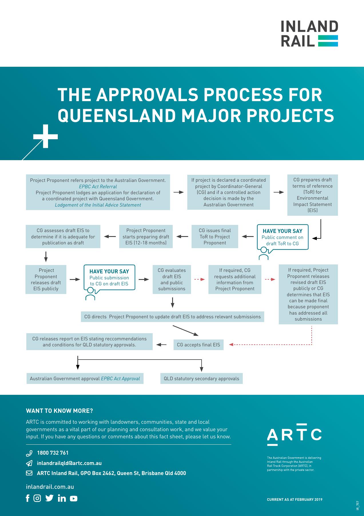
Process to assess Queensland major projects
A flow chart detailing the approval process for major projects in Queensland, including opportunities for public input.
Environmental investigations
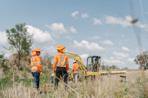
We have undertaken extensive field studies to gain an understanding of the environmental features, technical challenges and opportunities. This also ensures the project’s regulatory requirements are met by minimising and adequately mitigating impacts to the environment.
These have included:
- geotechnical and ecological surveys – to gather information about soil, ecological habitats and communities
- hydrology studies – to examine historical and predicted flooding and surface water movements
- noise, air quality and vibration surveys – to measure current levels at key project sites and assess the operational levels across the entire alignment
- surface water and groundwater baseline studies
- utility identification surveys – to identify infrastructure such as electrical, gas and water pipelines
- traffic surveys – to establish existing vehicle class, movements and volumes on local roads and highways
- land and heritage surveys – to identify property boundaries and investigate any evidence of Aboriginal and non-Aboriginal artefacts and heritage.
Site investigations, environmental assessments and field studies will continue to occur as we consult with landowners, councils and other key stakeholders. Field investigations and surveys will occur on public land, road reserves and the Queensland rail corridor. Investigations on private property will be arranged with individual landowners. All investigations are weather permitting.
Crossing the Condamine floodplain
Since the release of the proposed Condamine floodplain crossing model and design in late 2018, we have continued consulting with landowners and key stakeholders to update the flood model and crossing design.
Flood model
The flood model has been expanded to include additional local flow paths, in particular within the Back Creek catchment, and has been validated against the 2013 flood event.
Works have included:
- conducting further tests to determine how inflows from local creeks may impact water levels and velocities in a rare flood event
- improving our flood frequency analysis using additional data from the Warwick and Cecil Weir stream gauges
- gathering anecdotal data of historic flood events prior to 1921.
While this work has improved our understanding, it has not resulted in any significant changes to the overall floodplain model or required us to make considerable updates to the crossing design.
Crossing design
Local community feedback has informed the proposed Condamine floodplain crossing design. The proposed design remains within the existing rail corridor, and includes:
- building six bridges (6.1km total bridge length)
- constructing approximately 500 culverts (900mm – 2.1m in diameter)
- extending the proposed bridge over the North Branch by approximately 250m north
- moving the proposed Yandilla rail bridge further south and combining with the proposed Grasstree Creek bridge
- increasing the number of proposed culverts near the Yandilla grain silos to ensure the drainage channel to the south of the silos has enough culverts to convey flood water.
The proposed Condamine floodplain crossing design is subject to assessment as part of the draft Environmental Impact Statement process and may change as a result of conditions of approval, further investigations, or detailed design.
Consultation with affected landowners is ongoing.
