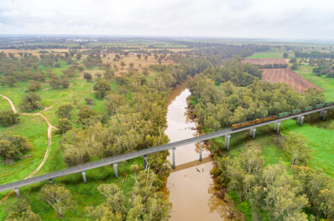
The Inland Rail alignment crosses several watercourses and floodplains in Northern NSW (NNSW). We acknowledge that responsibly managing the potential risks of flooding in known flood prone regions is a fundamental expectation of communities along the alignment.
We’re committed to designing, building, and operating Inland Rail to have minimal impact on existing flood water flow and the surrounding environment. Our approach to this is closely monitored and assessed by the NSW Department of Planning, Housing and Infrastructure (DPHI).
We also listen to feedback from landowners, councils, government agencies and hydrology experts and use the latest local flood data to inform our designs. This ensures that the infrastructure we build is resilient and balances the needs of the Inland Rail program with community expectations.
Our flood modelling shows the impacts of various flood scenarios prior to construction of Inland Rail. We then overlay the model with engineering designs to identify any changes to hydrology or flooding caused by the new or upgraded railway. The design is progressively refined to reduce or where feasible, remove negative impacts.

Our approach to flood impact modelling
Inland Rail has used evidence from landowners, councils and government agencies to complete detailed hydrological and geomorphological (erosion) assessments which align with national guidelines and industry best practice.
We’ve engaged leading engineering design consultancies to develop the hydraulic models for the Environmental Impact Statements for these sections of Inland Rail in NNSW.
Narromine to Narrabri: Jacobs and GHD Joint Venture.
Narrabri to North Star Phase 2: WSP and Mott MacDonald Joint Venture.
North Star to Border: AECOM and Aurecon Joint Venture. Also known as FFJV (Future Freight Join Venture).
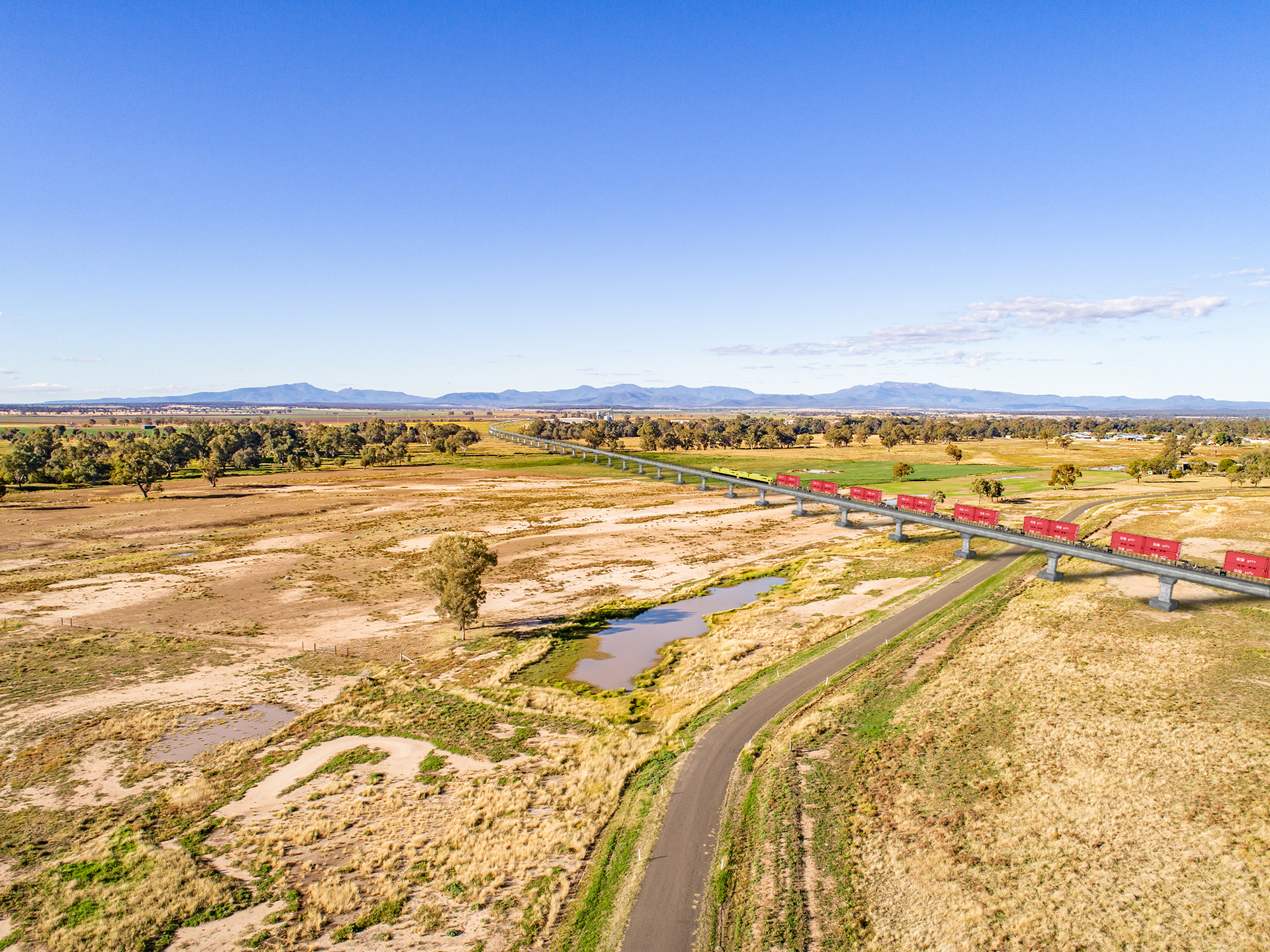
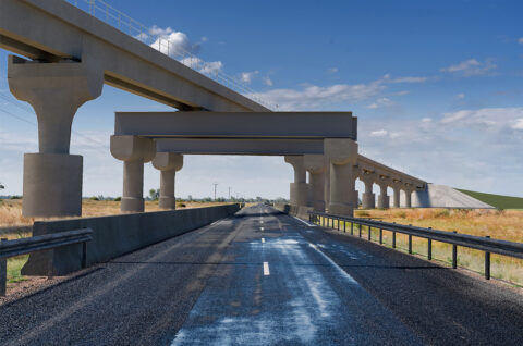
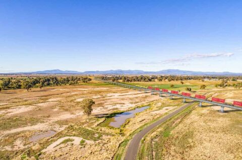
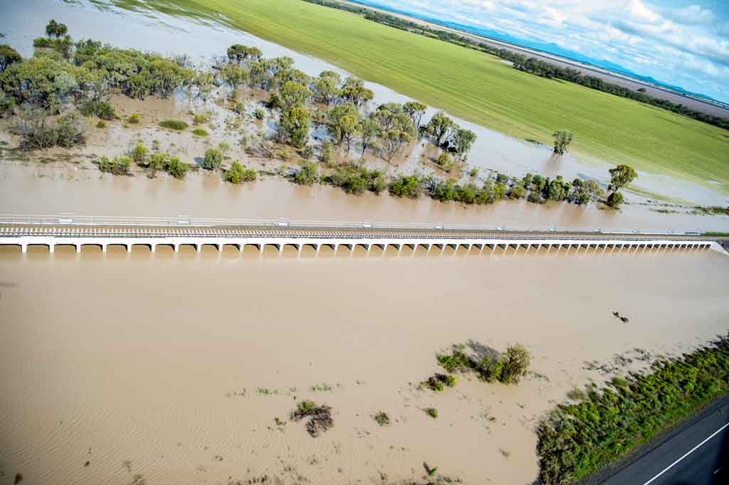
Visualisation of the proposed 4km long viaduct over the floodplain that includes Narrabri Creek and the Namoi River
We’re now completing further work on the hydrology and hydraulic models in the southern sections of the Narromine to Narrabri project and around Moree on the Narrabri to North star project.
Models are independently peer reviewed and will continue to be refined and recalibrated as new data becomes available, ensuring the latest information is used to inform design refinement.
Our industry leading engineering design consultancies consider these factors when developing hydraulic models:
- water depth
- water flow rate and velocity
- extent of flooding
- flooding hazard
- flood duration
- flood event modelling data from councils and government agencies
- landowner feedback, including imagery of historic events
- real-time data collection in periods of flood
- satellite imagery of previous flood events.
Other factors evaluated may include rainfall data, soil type, landscape features and land use, topography, stream gauge data, built environment, floodplain management infrastructure, water harvesting and storage infrastructure.
A key input into our flood modelling is the Australian Rainfall and Runoff (ARR) Guideline. It gives us reliable tools and data to estimate how floods might behave in different parts of Australia. The latest version of the guideline includes new advice and updates based on the latest research and adjusts rainfall predictions to better account for future weather patterns.
The guideline is managed by GeoScience Australia and is regularly updated. The most recent updates were made in 2019, with further improvements added in 2024.
During our planning and development phase we also consider the effects of planned and current infrastructure, to ensure our hydrology data is future proofed. The combined impacts are also referred to as cumulative impacts.
How we talk about flood risk
Flooding risk is reported as Annual Exceedance Probability (AEP), which measures the likelihood of a flood or rainfall event of a specific magnitude occurring or being exceeded in any given year. For example a 1% AEP has a 1% chance of occurring in a one-year period. 1% AEP is sometimes expressed as a 1 in 100-year event. This can be misleading as theoretically a 1% AEP event can and has occurred several years in a row in some communities in Australia.
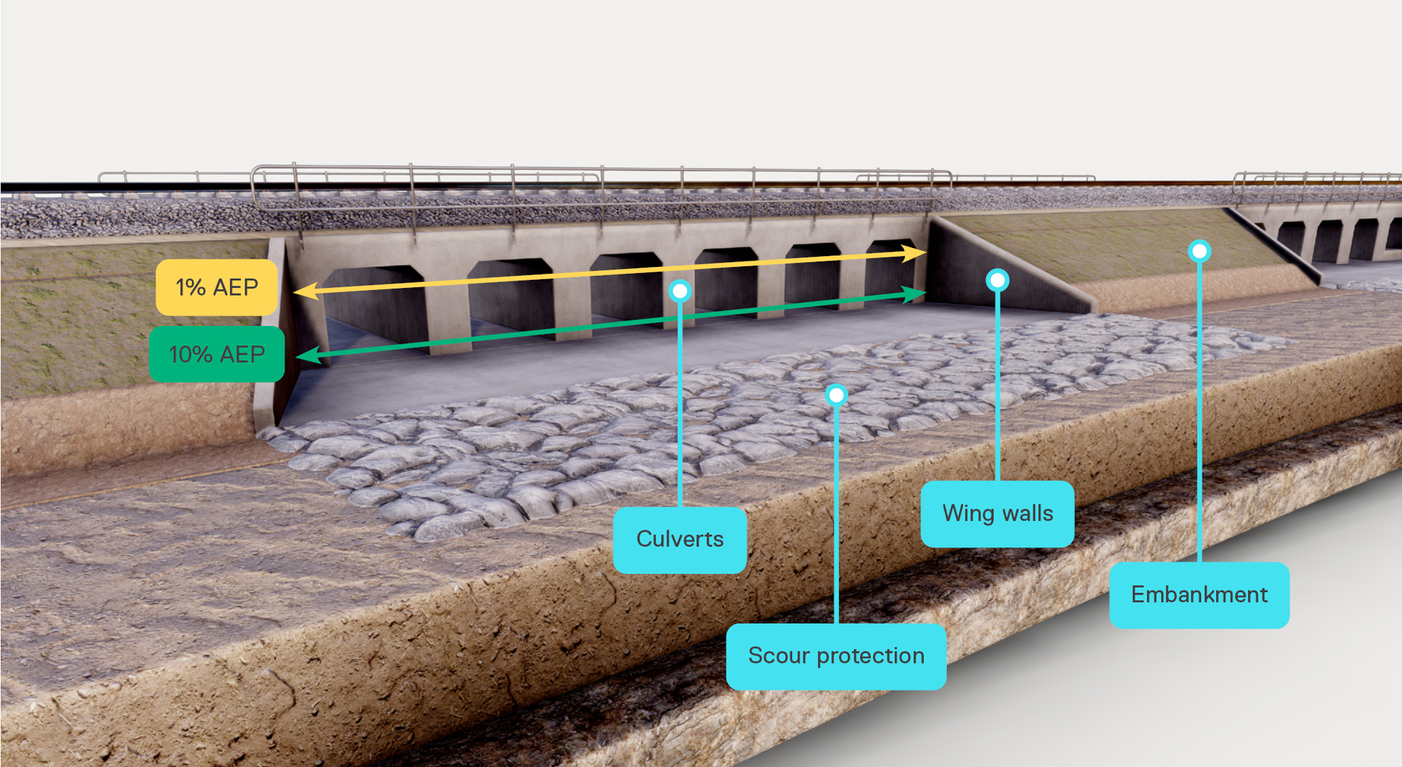
Example of a typical culvert bank showing the relationship between 1% and 10% AEP flood peak level.
How we ensure hydraulic models are accurate
After significant floods, we validate our models against observed impacts on the ground. We have used the following flooding events to calibrate hydraulic models:
Narromine
- August 1990
- August 1998
- November 2000
- November 2010
- October 2022
- November 2022.
Narrabri:
- Namoi River catchment: February 1971, February 1995, November 2000, November 2021, October 2022, February 2023 and December 2004
- Mulgate Creek and Long Gully: December 2004 and February 2023
- Bohena Creek: September 1998, July 1998, October and November 2022.
Moree:
- February 1955
- July 1998
- January 2004
- November 2011
- February 2012
- March 2021
- October 2022.
Macintyre River catchment:
- February 1976
- January 1996
- January 2011.
Flood impact limits
The NSW Minister for Planning and Public Spaces has set limits on the maximum impact that Inland Rail can cause before management measures are required, for scenarios up to and including the 1% AEP flood event.
These limits are known as Quantitative Design Limits (QDLs) and are set at varying levels, depending on the environment and flood affected object or area such as a building, road or farm.
Below are examples of QDLs for peak flood water levels which are set for Inland Rail’s NSW sections:
Inhabited residential buildings can generally experience up to a 10mm increase in flood water levels caused by Inland Rail infrastructure. If modelling shows flood levels are likely to rise higher than 10mm, this is deemed an exceedance and Inland Rail is required to address it.
Agricultural land has an allowance of up to 200mm of additional flood water caused by Inland Rail infrastructure. If modelling shows levels above 200mm, it will be deemed an exceedance requiring management measures.
During the design refinement phase hydrologists will work with the engineering designers to test proposed designs and amend them to remove exceedances wherever possible. QDLs cover changes between existing and new conditions related to:
Varying limits are set for a range of land uses and at flood sensitive receptors.
Maintaining existing velocities where practical and understanding any changes in the speed of water exiting culverts/bridges. Providing appropriate mitigation measures, considering soil conditions.
Understanding the impact of any changes to how long areas stay flooded related to land and infrastructure.
Limiting any changes in flood hazard (a metric that identifies higher risk and lower risk flood affected areas), measured as the depth of water flow multiplied by the velocity.
Where Inland Rail infrastructure causes flooding impacts to exceed limits or QDLs, we will use design solutions to reduce them where possible. If our design approach is unable to reduce an exceedance (also called a non-compliance) we will suggest other ways to reduce impacts of those exceedances.
Landowners will be consulted, potentially over several meetings, to ensure all impacts and potential management measures are discussed and understood. Inland Rail will actively seek to find a solution that is acceptable to both parties.
If Inland Rail and an impacted landowner with exceedances fail to come to an agreement, the matter may be referred to the Independent Flood Impact Assessment Panel (IFIAP) who will work with landowners to independently assess the potential impact and proposed solution.*
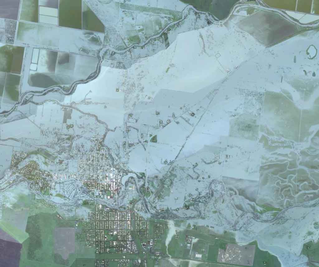
The flood model for Moree and surrounds showing a 1% AEP event. This image shows current scenario, without Inland Rail infrastructure.
How design initiatives will mitigate and minimise flood impacts
We will consult with landowners and specialists to ensure we minimise changes to hydrological conditions because of Inland Rail. Our engineers will work closely with landowners and hydrologists to ensure property-specific detail is understood and considered as design solutions are developed.
We will implement a flood and geomorphic impacts mitigation framework and further design treatments to eliminate, reduce and address potential flood impacts where possible. Specific mitigation measures will mostly be design-based solutions such as additional culverts, bridges and scour protection, aimed at further eliminating and reducing impacts.
For example, during the Narrabri to North Star Phase 2 EIS finalisation, our hydrologists refined the flood model for the section. Since then, the design has been updated to include approximately 700 additional box culverts to balance flows and reduce flood impacts.
To address concerns about dispersive soils, cross-drainage design will minimise impacts on surrounding drainage and flow paths, preventing avoidable erosion, siltation, and watercourse instability.
Scour and erosion protection measures will generally be implemented around culvert headwalls, drainage discharge pathways, and bridge abutments.
We’ll also publish a Flood Design Verification Report (FDVR) that details flood behaviour under existing conditions and how this may change under the design*. The FDVR is assessed and approved by DPHI.
What happens when trains start running on the line?
All Inland Rail sections are subject to strict environmental conditions of approval including several related to flood impact monitoring, reporting and management. These conditions are designed to monitor flood behaviour, assess that impacts occur as predicted by our model and address any non-compliant impacts.
The ultimate manager of Inland Rail infrastructure, railway operator Australian Rail Track Corporation (ARTC), will oversee compliance monitoring for up to 15 years after Inland Rail operations begin.
ARTC is required to show evidence of the following two activities for Inland Rail’s NNSW sections:
1. Operational Erosion Mitigation and Monitoring Program* (OEMMP)
An OEMMP will be developed in consultation with landowners and DPHI to monitor any changes in erosion which may be caused by the railway. The program must:
- identify monitoring areas including the upstream and downstream ends of all drainage structures,
- provide a baseline pre-construction survey of conditions and report annually and after rain events greater than a 20% AEP for a period of 15 years or as otherwise approved by the Planning Secretary
- outline a process for adaptive management and mitigation measures if monitoring determines the project is impacting erosion and a process for addressing complaints received that relate to erosion.
2. Flood Review report after construction
Following the first of several defined flood events (i.e. greater than 1% AEP, 1-5% AEP, 5-10% AEP and 10-20% AEP) post construction, an experienced hydrologist must prepare a Flood Review Report that compares the observed flooding characteristics to what was predicted.
The report must identify properties and infrastructure affected by flooding and document any adverse impacts caused by Inland Rail. Following consultation with affected parties, the report must propose mitigation measures to reduce future adverse impacts including timing and responsibilities for implementation.
You can read more about flooding impact assessment and conditions of approval by reviewing the Environment Impact Statements for Inland Rail’s Narromine to Narrabri, Narrabri to North Star and North Star to NSW/ Qld Border sections. Please visit the NSW Government’s website at pp.planningportal.nsw.gov.au/major-projects and search by section name.
* Not applicable for Narrabri to North Star Phase 1, including the Tapscott Road to Alice Street segment
Talk to the Inland Rail team
If you would like to contact Inland Rail’s NSW team, you can either call, send an email or visit one of our offices. We also hold regular events, and you’re welcome to subscribe to our enewsletter.
| Phone | 1800 732 761 during business hours or leave a message and we'll get back to you. |
| inlandrailnsw@inlandrail.com.au | |
| Inland Rail Pty Ltd, 85 Maitland Street, Narrabri NSW 2390 | |
| Visit | 85 Maitland Street, Narrabri, Monday to Friday, 9am to 4pm |
Alternatively, you can fill out the below form, and request a team member to contact you:
"*" indicates required fields