Consultation
Revised reference design
The Calvert to Kagaru project began consultation on the revised reference design for the project in November 2022.
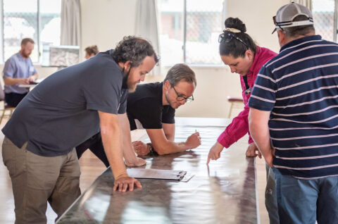
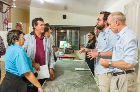
Consultation started with one-on-one discussions with landowners directly impacted by the proposed changes in the revised reference design, local councils, the Department of Transport and Main Roads, emergency services and other Queensland state agencies.
Engagement with the wider project community followed with an electronic newsletter, printed newsletter, project update video, CCC meetings and workshops on the proposed changes.
Road network changes
The proposed road network changes below are a result of the extensive engagement with landowners, key stakeholders and community members. We have also incorporated feedback from the submissions to the Queensland Government Coordinator-General’s Calvert to Kagaru Environmental Impact Statement process.
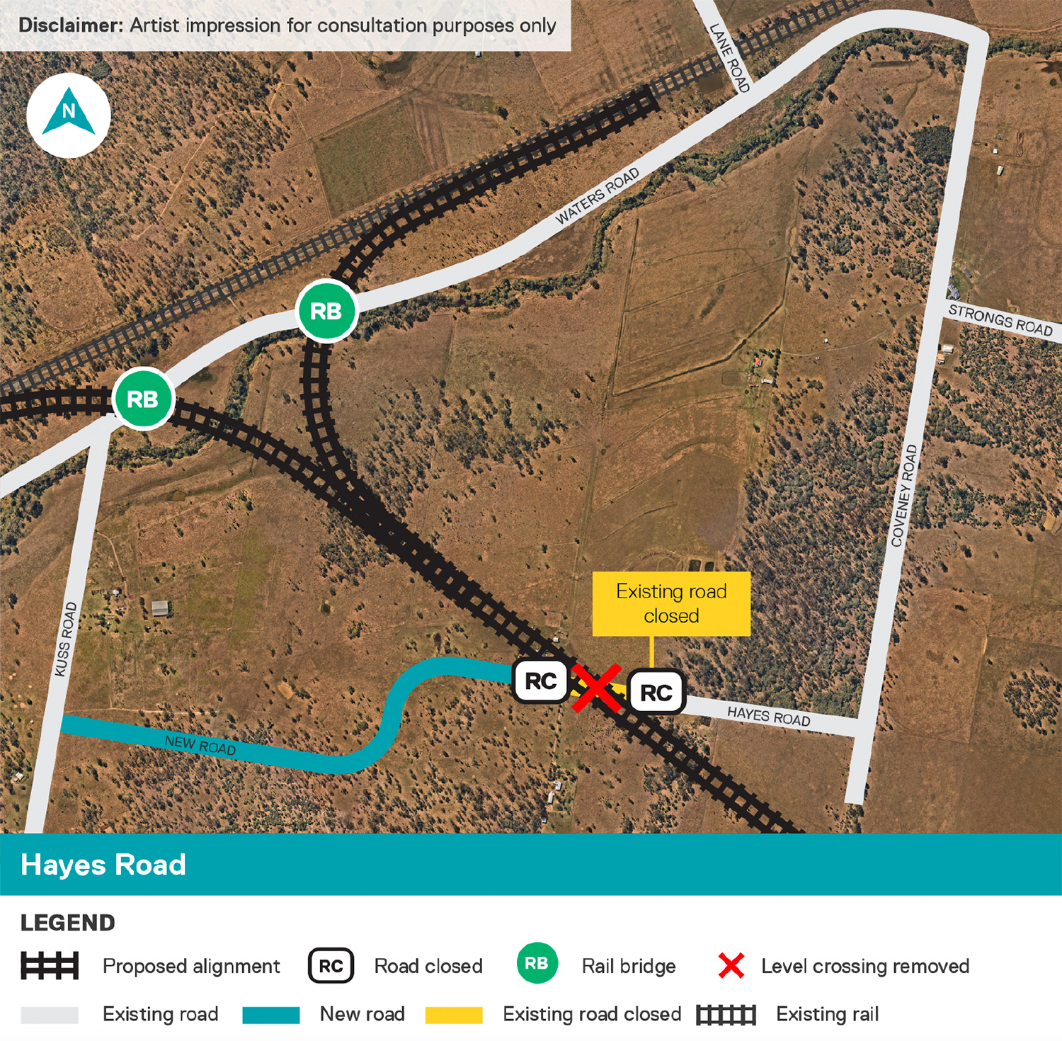
Hayes Road, Lanefield
- Hayes Road to be closed either side of the proposed rail line, removing the level crossing.
- Alternate access provided via Kuss Road and new road extension to the western ‘segment’ of Hayes Road.
- The design utilises the existing road reserve where possible to minimise property impacts.
- Road will predominantly match existing terrain levels.
- Safer access for community and emergency services.
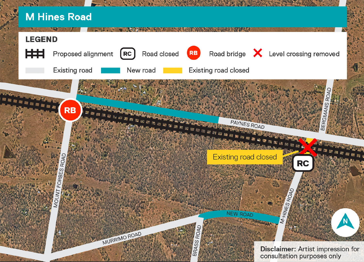
M Hines Road, Ebenezer
- M Hines Road to be closed south of the proposed rail line, removing the previously proposed level crossing.
- Alternate access provided by a new road upgrade/800m long extension of Murrimo Road between M Hines Road and Brass Road.
- This will provide north-south access to properties on M Hines Road via the proposed Mount Forbes Road overpass.
- The design follows the existing Murrimo Road reserve, where practical, to minimise property impacts.
- Road will match existing terrain levels.
- Safer access for community and emergency services.
Cunningham Highway
- Change to a rail over road bridge (previous reference design was a road over rail bridge).
- This change will reduce construction and traffic impacts.

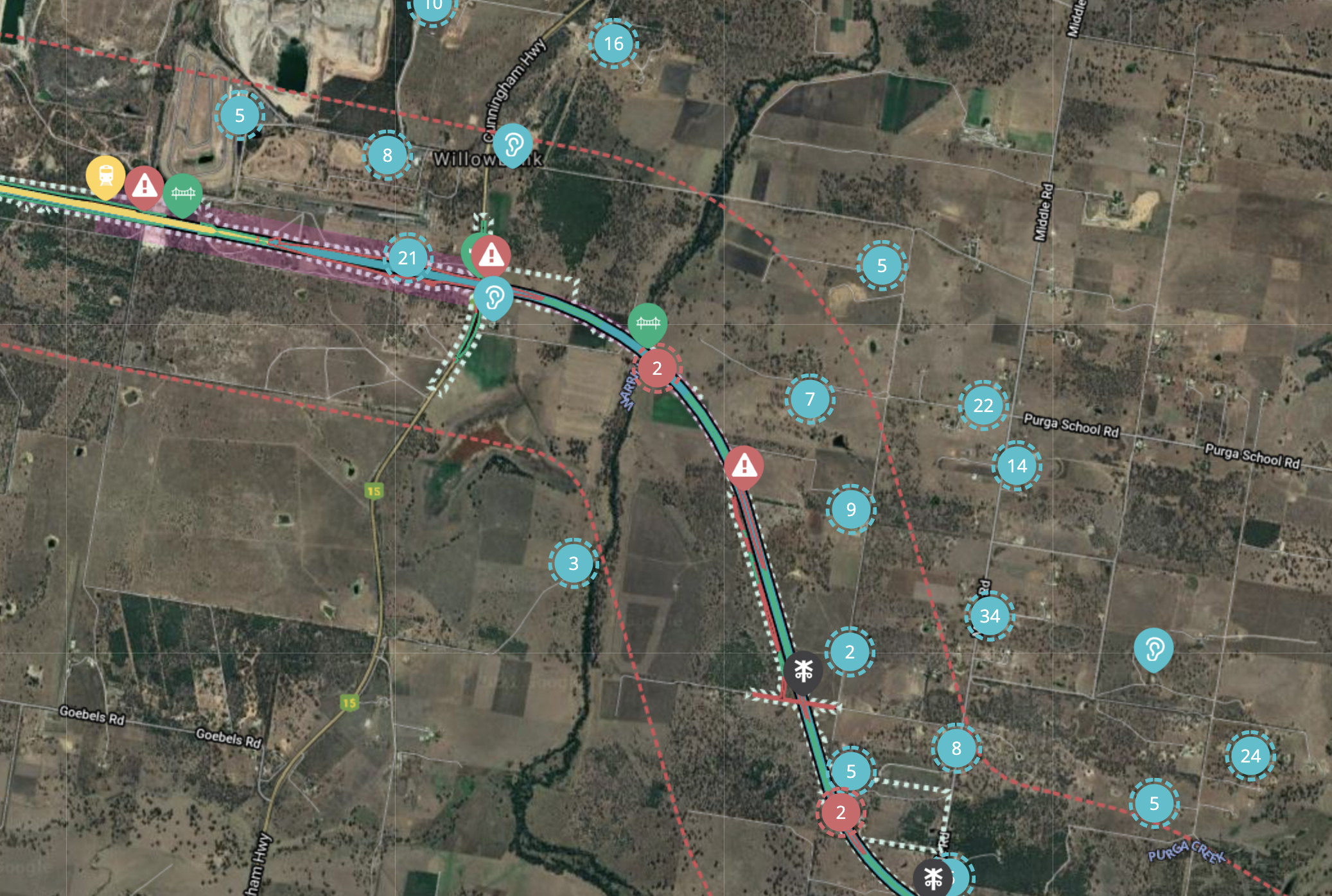
Click image to enlarge
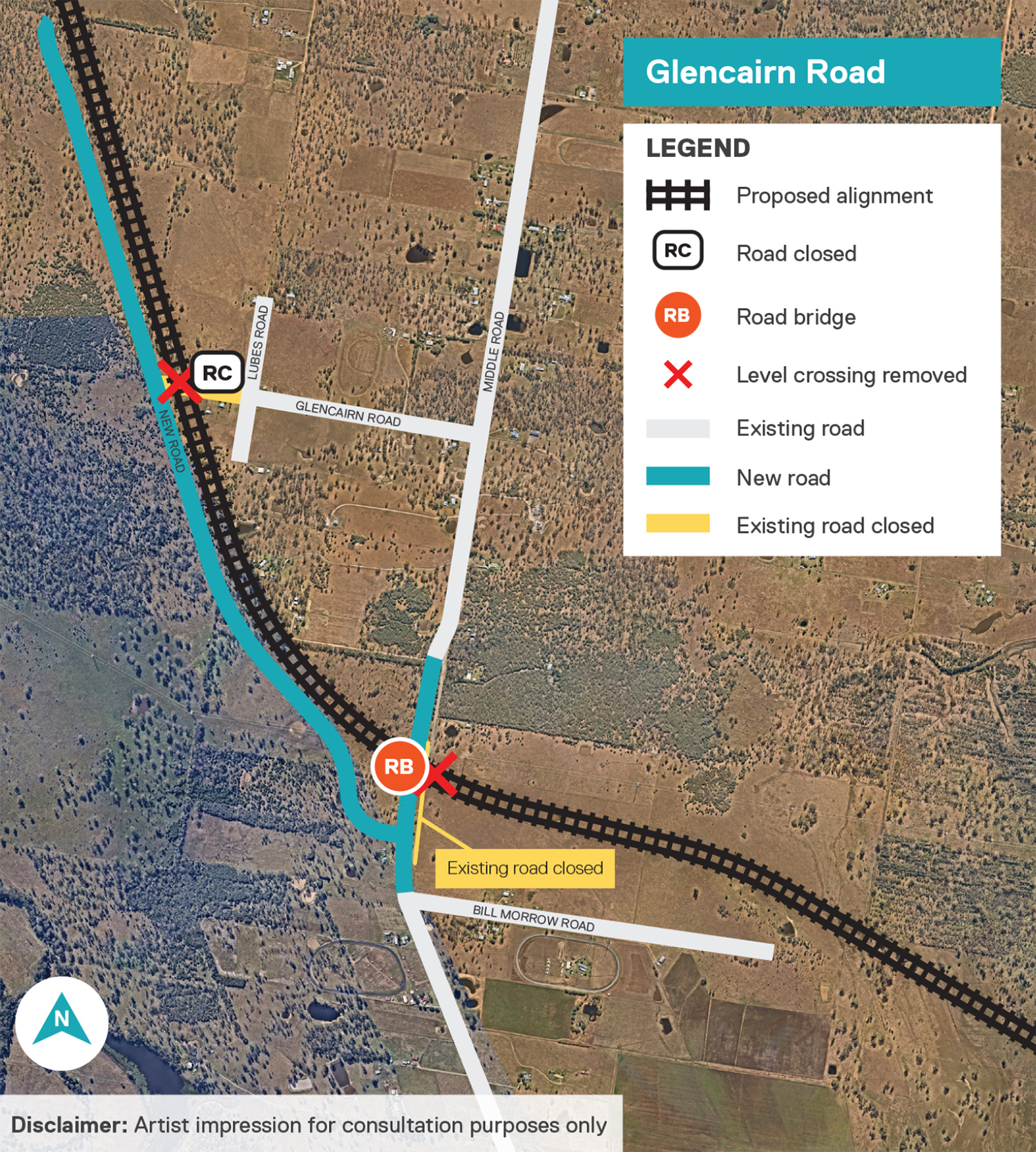
Glencairn Road, Purga
- The Glencairn Road reference design level crossing will be removed.
- Alternate access provided via a new road to the west of and running parallel to the rail alignment.
- The new road connects to Middle Road at a new T intersection.
- The intersection will provide Glencairn Road users local connections to the north and south.
- The new road is designed to minimise impacts on adjacent properties.
- Road will match existing terrain levels.
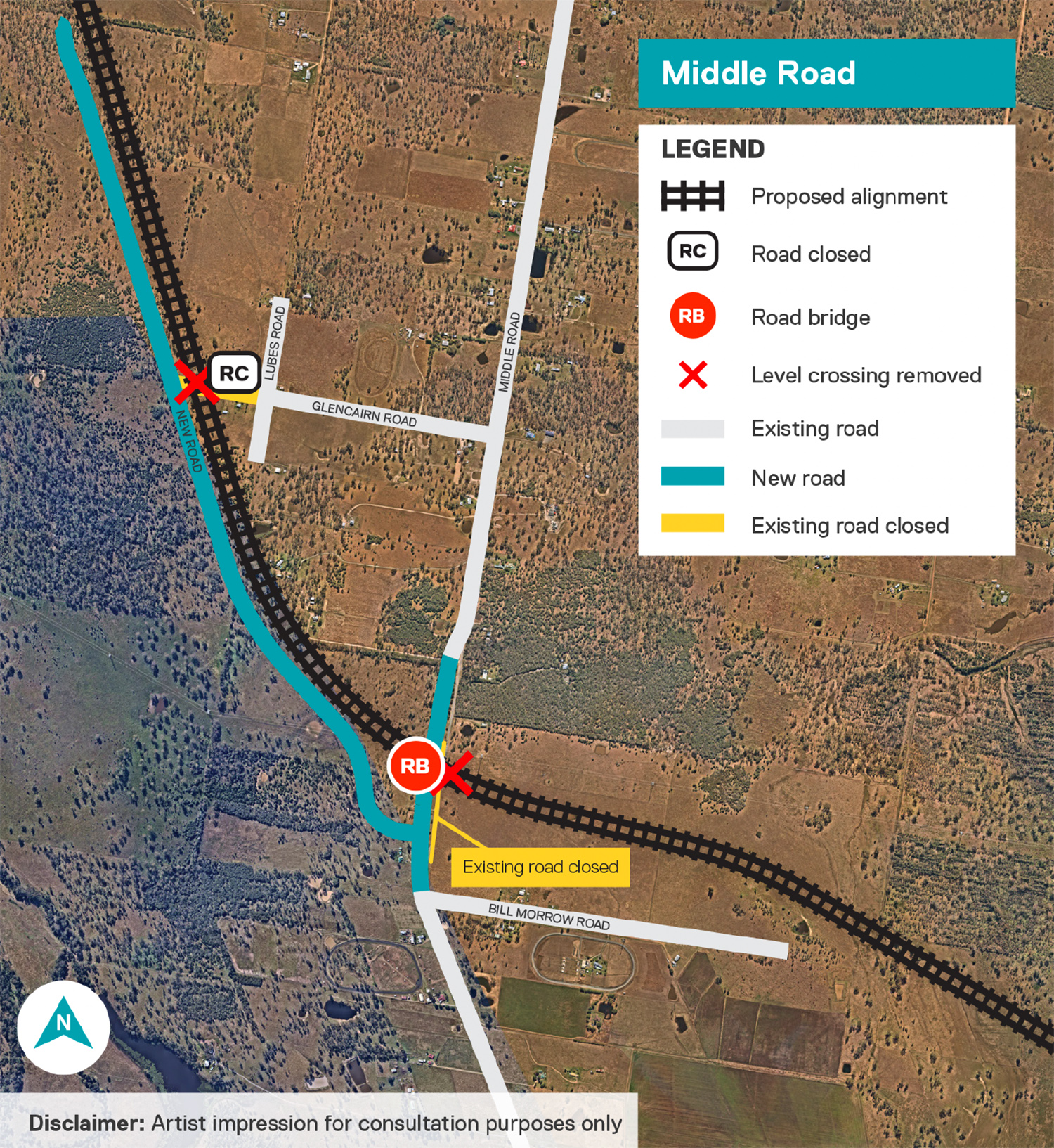
Middle Road, Purga
- Previously proposed level crossing removed and replaced with road bridge.
- A road over rail bridge will provide unbroken connections north and south of the railway line.
- The road is shifted approximately 40m west of the existing Middle Road to reduce impacts to the Purga Environmental Reserve.
- Staggered T intersections for the new road and Bill Morrow Road to create safer road intersections.
- New road minimises impacts on adjacent properties.
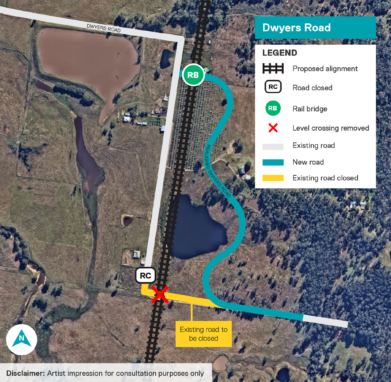
Dwyers Road, Washpool
- The revised design provides a rail over road bridge approximately 800m north of the proposed active level crossing location in the reference design.
- A two-way underpass has been provided.
- New, realigned road to the east of the rail line.
- The realigned road will cater for the traffic volume and provide improved connectivity in this section.
Washpool Road, Washpool
- The updated design replaces the level crossing with a road over rail grade separation.
- In addition to the overpass, the road will also be re-aligned with the proposed design introducing additional curvature for speed requirements.
- The design also seeks to provide more balanced earthworks and a reduced environmental footprint.
- The realigned road will sufficiently cater for the traffic volume and provide improved connectivity in this section.
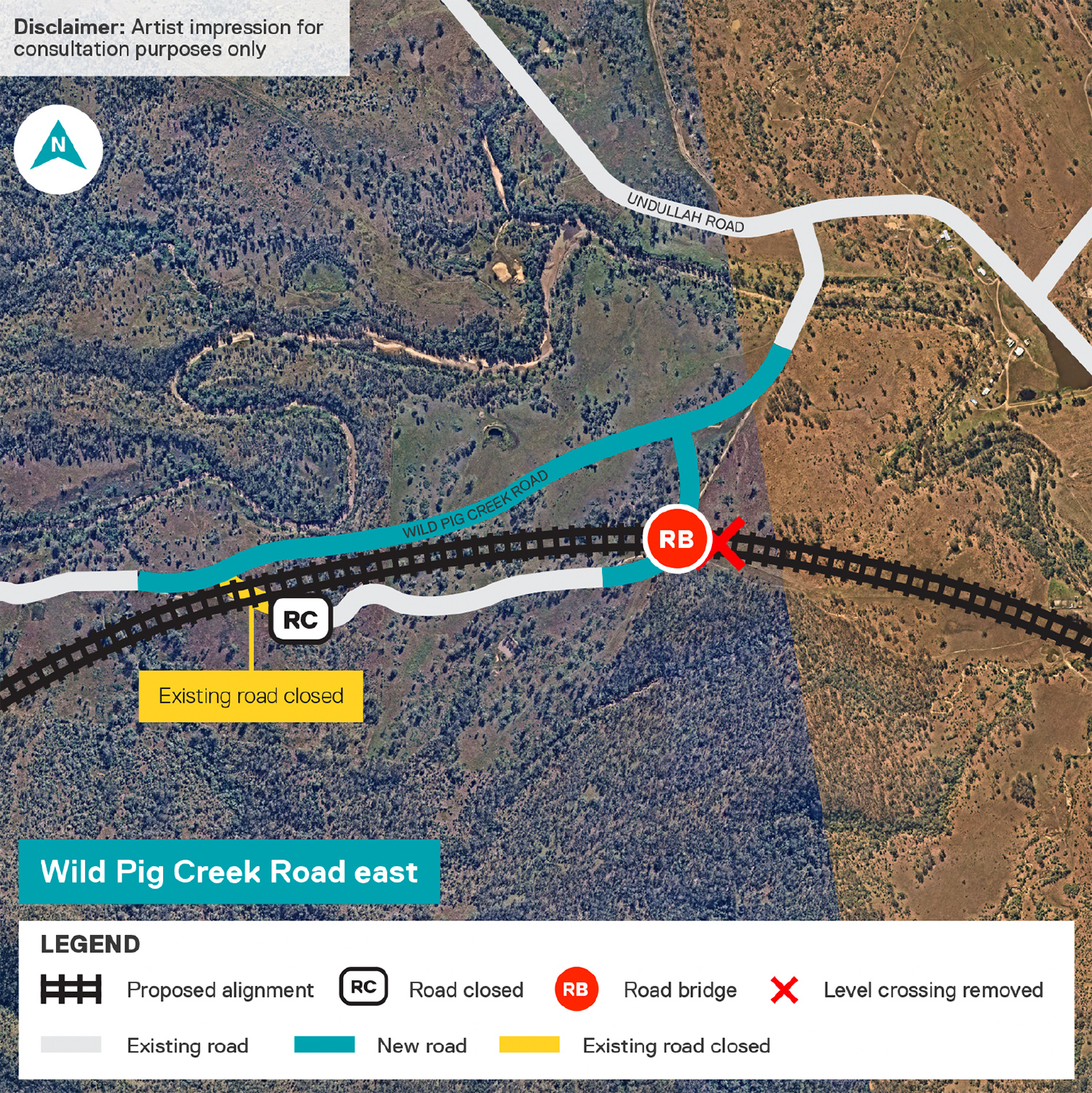
Wild Pig Creek Road east
- Level crossing closed.
- Road to be re-aligned north of the railway line.
- Rail line moves further south.
- Road bridge provides improved connectivity to the south.
- Design pursues balanced earthworks and a reduced environmental footprint.
Draft Environmental Impact Statement
The Calvert to Kagaru draft Environmental Impact Statement (EIS) public display commenced on Saturday 19 December 2020 and concluded on Monday 8 March 2021.
The Coordinator-General has evaluated the draft EIS, including public exhibition submissions, and in September 2021, requested ARTC to provide further information regarding the environmental impacts of the project and submit a revised draft EIS.
A total of 846 public submissions were received on the draft EIS which the Coordinator-General has provided ARTC to respond to. The response to the submissions will be included as part of the revised draft EIS.
ARTC will review the request for additional information, undertake additional field work, update the applicable draft EIS chapters and submit a revised draft EIS.
The Coordinator-General also decided the revised draft EIS will be publicly notified. Details for further public consultation will be provided in 2022 along with information on how you can have your say.
For more information about the EIS process and next steps, visit the Queensland Coordinator-General’s website.
How to view the draft EIS
You can view the draft EIS online here.
Contact us
Our project team is still available to discuss the project if you have any questions. Please call us on 1800 732 761 or email inlandrailqld@artc.com.au.
Calvert to Kagaru EIS summary of findings
A draft Environmental Impact Statement (EIS) has been prepared for the Calvert to Kagaru Project. The EIS describes the Project, considers potential environmental, social and economic impacts of the Project, and identifies measures to avoid, minimise and mitigate these impacts.
Your consultative committee
A Community Consultative Committees (CCC) has been established for local communities in the Calvert to Kagaru area.
This CCC provides a forum to share project information, discuss topics of interest, and address any issues or community concerns. Importantly, it also provides an opportunity for community representatives to share their knowledge and experience on key issues with the Inland Rail team.
